
Severe Storms To Strike The Northeast Down Into The Southeast
Strong to severe thunderstorms are likely to develop across the Northeast, Mid-Atlantic and parts of the Southeast later this afternoon and evening leading to travel delays.
A potent cold front will march across these areas later this afternoon and evening causing strong to severe thunderstorms to develop. New England all the way down into the Southeast will see the risks for heavy downpours, strong wind gusts up to 50-60 mph, hail and even isolated tornadoes.
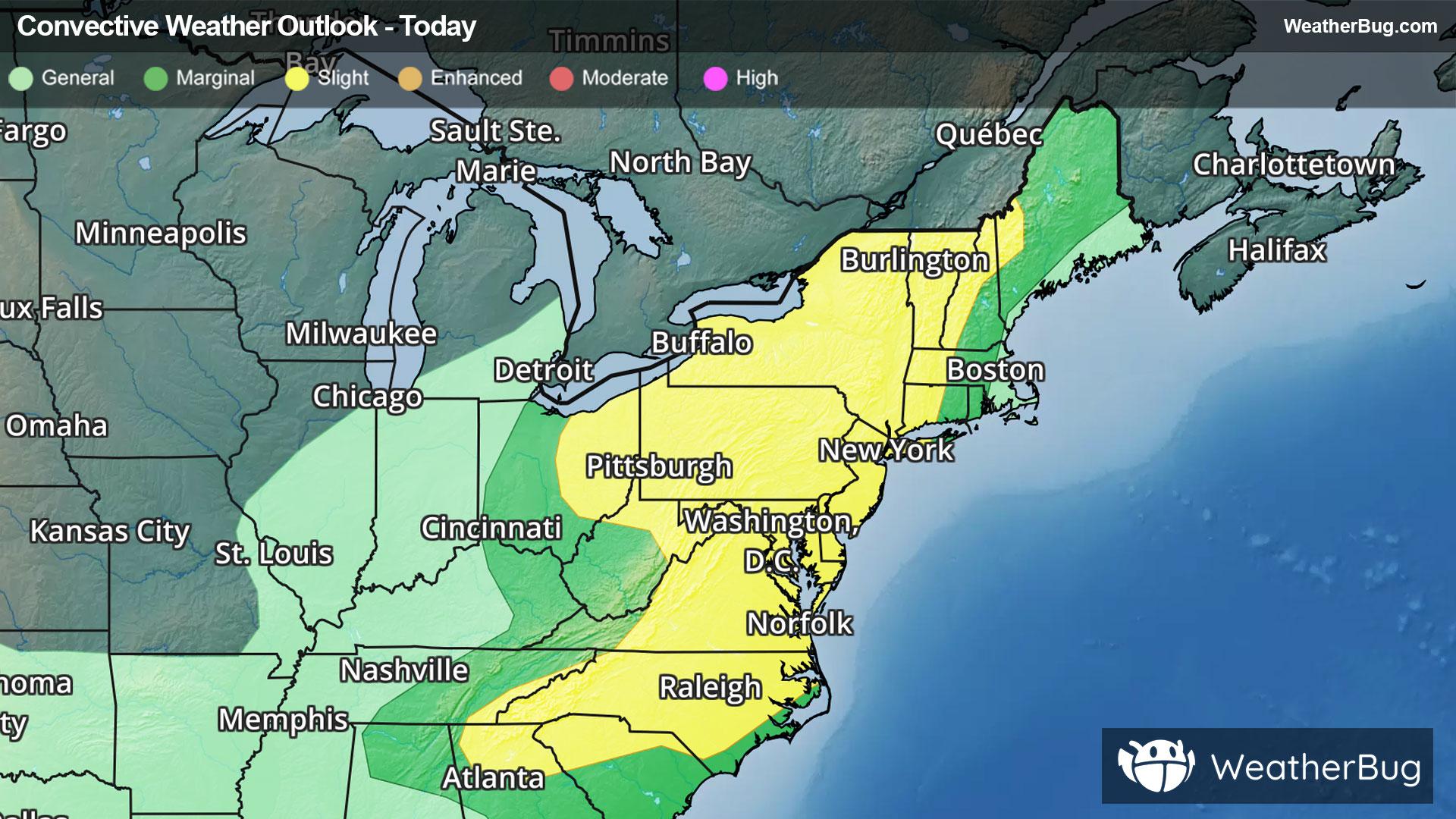
The government's Storm Prediction Center has issued a large Slight Risk, or a 2 out of 5 on the severe weather probability scale, across parts of New England, Mid-Atlantic and Southeast. Cities included are New York, Philadelphia, Baltimore, Washington, Richmond, Va., and Raleigh and Charlotte, N.C. The major I-95 corridor will likely experience impacts from this severe weather event.
Make sure to know the difference between a watch and a warning should they be issued. A "watch" means that conditions are favorable for severe weather to occur, and to be on alert for any rapidly changing conditions. A "warning" means that severe weather is imminent, and you should act fast to remain safe.
The best way to remain safe is to stay prepared and informed about your local weather. Have a severe weather kit packed with a battery-operated radio, water, and non-perishable food items. Also, check the WeatherBug app frequently for any updates on today's severe weather. Remember, "When Thunder Roars, Go Indoors!"